
Loutolim
Updates
Jul 14, 2025

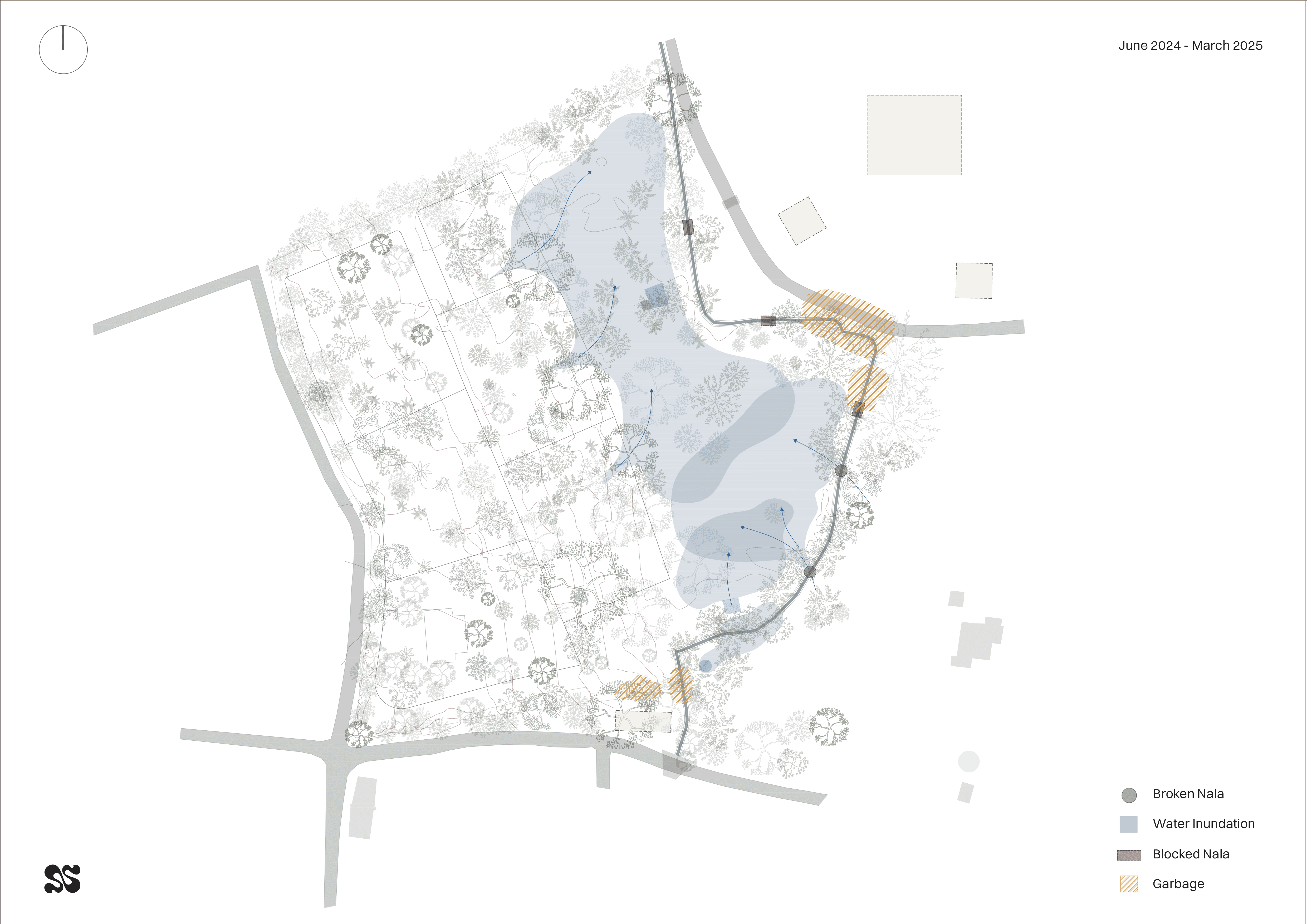
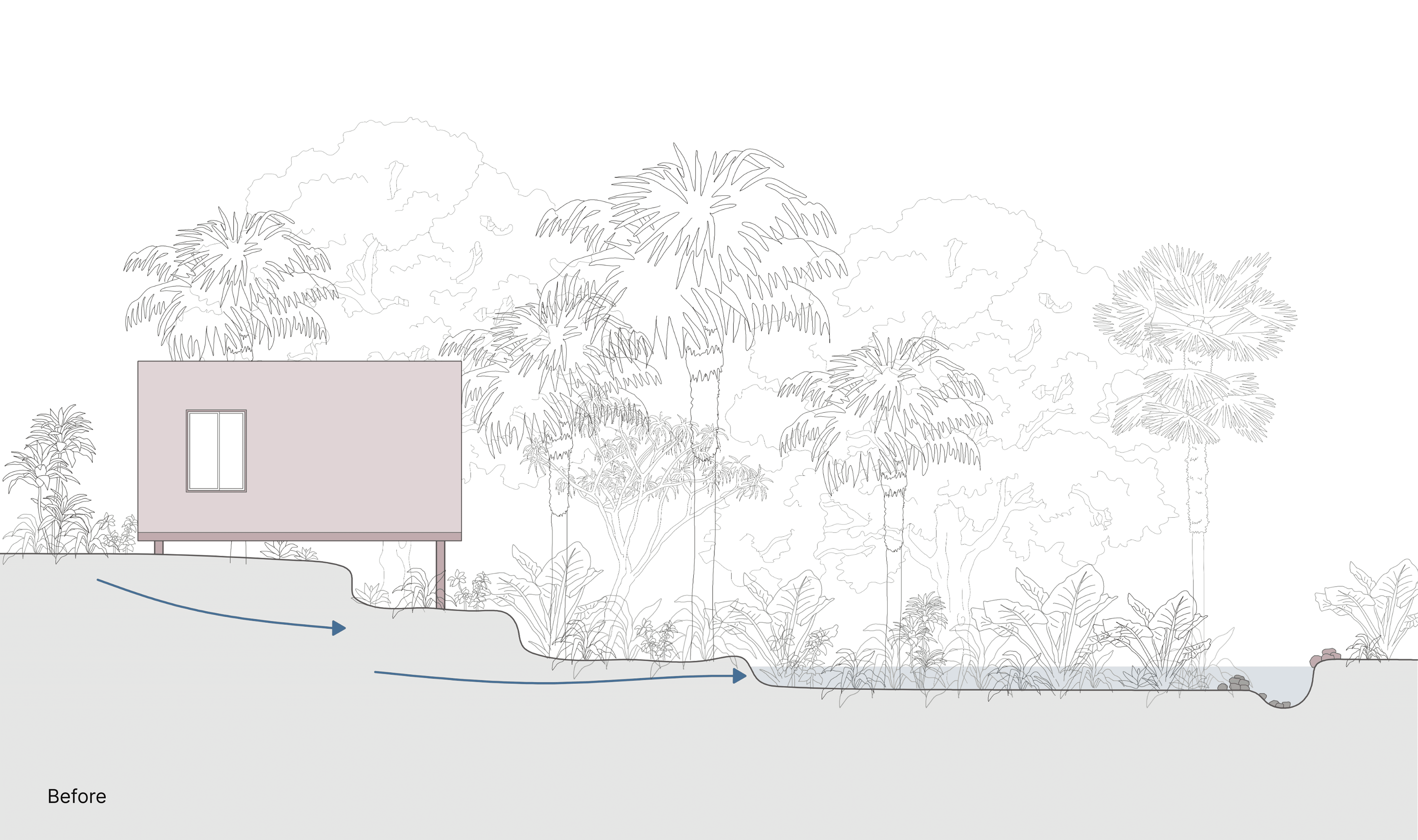
When we first set foot on the Loutolim site with Kapil in August 2024, it was the peak of the monsoons. The land was heavy with water, with much of it inaccessible due to flooding and overgrown greenery. We could only navigate narrow paths where rock and high ground allowed us to see small parts of the property. Even then, we suspected a deeper problem: the nala, which was supposed to channel water away, seemed to be leaking, pushing water back onto the site. Combined with the contours of the land, water found it easier to settle than to leave, turning large parts of the site into stagnant pools.
Layers of Neglect
The issues ran deeper than rainwater alone. Decades of neglect had led to broken stones, collapsed boundary walls, and the gradual erosion of soil into the nala. Villagers had used the area as an informal dump, leading to garbage accumulation both within the nala and across the site. During clean-up, we found everything from plastic waste to diapers, contributing to water contamination. This waste, combined with a raised silt level in the nala over decades, meant that the nala now sat at the same level or higher than the lower parts of the site, reversing the flow and flooding the commons instead of draining them.
We also observed that overflow from the existing well is contributing to water pooling on parts of the site. This overflow water eventually finds its way to the nala, but in the process, it causes temporary pools in certain areas, adding to the challenges of managing surface water during heavy rains.

A Manual Push for Change
In April 2025, we took on the task of restoring the nala and managing the water flow, entirely through manual work. We began by clearing garbage, rebuilding parts of the broken nala wall with stone, and dredging the nala to lower its level below the site wherever possible. This helped intercept the water from the neighbouring plot which was earlier entering the commons crossing the nala. This work was done without heavy machinery, using a trial-and-error approach over nearly three months, during which pre-monsoon rains tested our efforts.
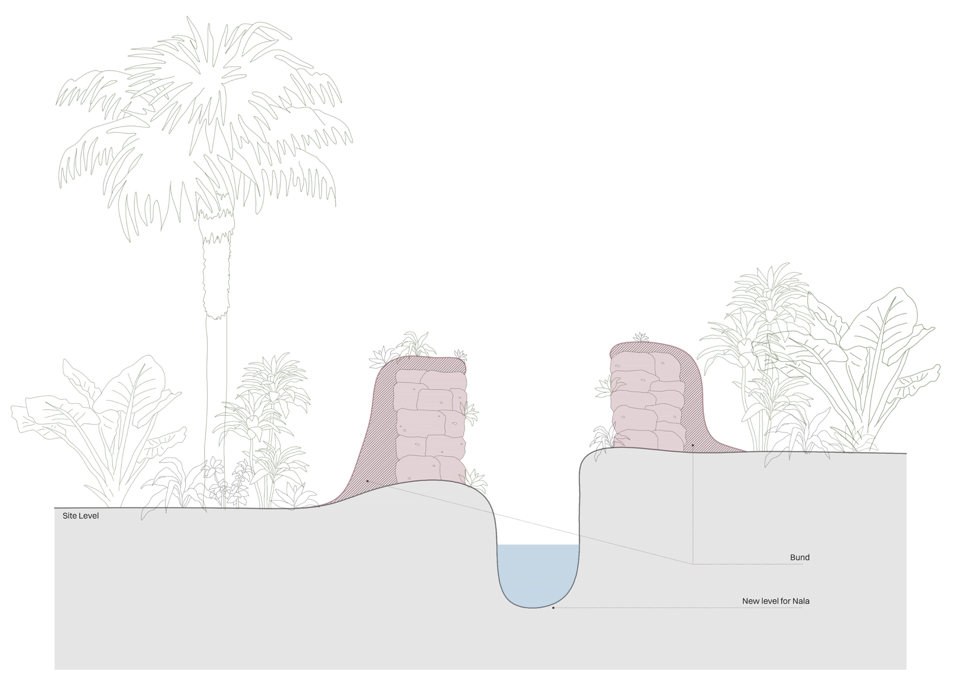
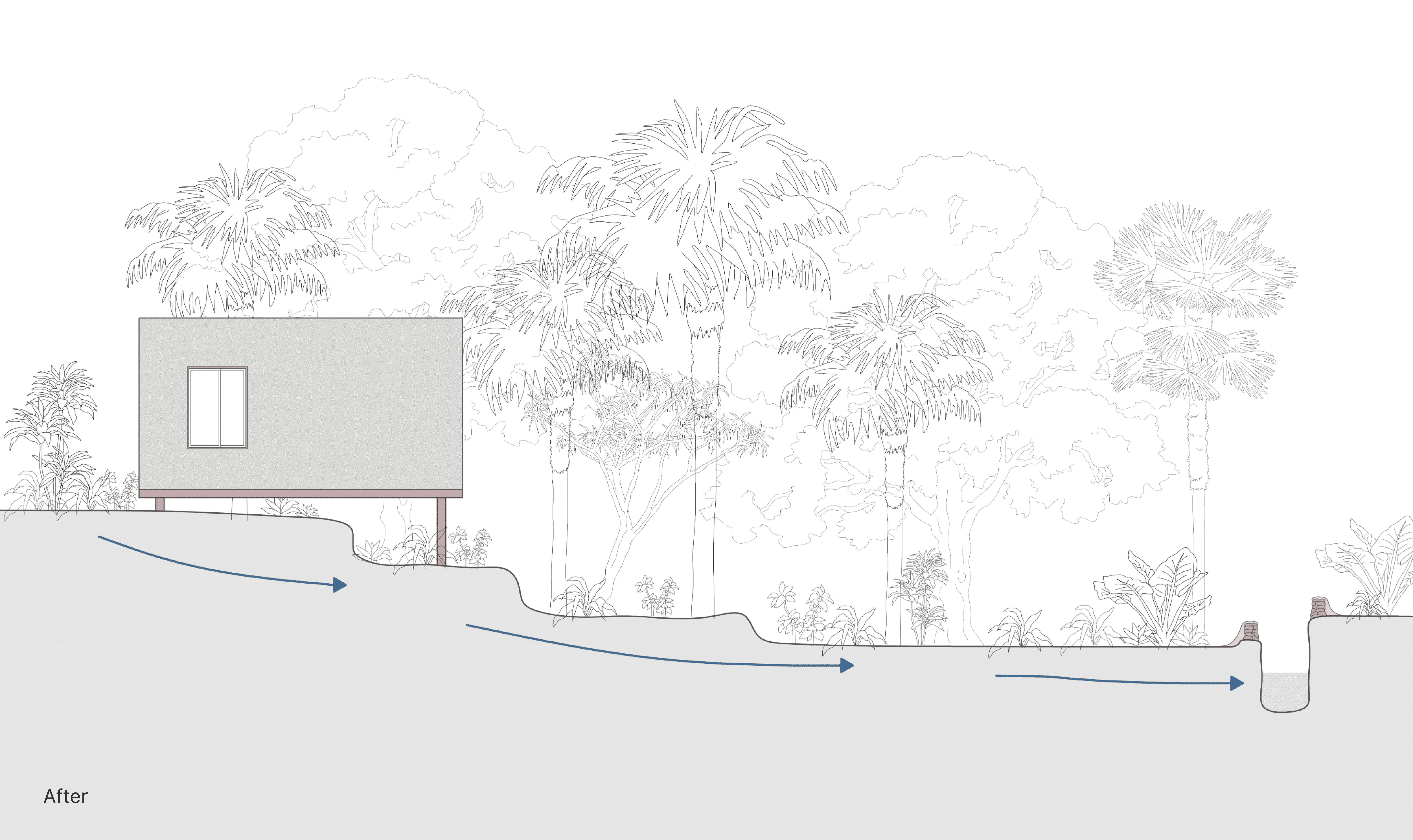
In areas where water flow was too strong, we temporarily created bunds inside the nala to hold back water, dredged sections of the nala, and then released the water to test if it would flow smoothly. In some areas, the lower nala level allowed water to return naturally, while in others, the water still found its way into the site through broken walls but could now exit through newly cleared paths. Please refer to the plans (name) capturing the real time water movement on site before and after the intervention.
What We Have Achieved
We have built bunds using the silt and soil dredged from the nala and stone/laterite to strengthen boundaries along the site’s edge, allowing water to seep back into the nala while reducing overflow. Importantly, we have now managed to dredge the level of the nala below the site level in several key areas. This change has allowed water, which previously had nowhere to go, to find its way back into the nala and exit the site naturally. Where water once flowed backward onto the land, it now moves through the site and drains efficiently.
As a result, water stagnation on the site has reduced, though challenges remain due to the uneven ground, plant overgrowth, and natural contours that can still cause isolated pockets of water to collect after heavy rain. We have also installed signage, engaged with the garbage contractor, and put up cameras to prevent further dumping on the site.
What Comes Next
A fully functional, long-term solution will come through landscape planning. Parag has assessed the site and is developing a water and plant management plan to further reduce stagnation and guide future interventions. This plan will be shared with Serie and Solarpunk Futures within the next 30 to 45 days to align with the overall site development timeline
Living with Water, Not Against It
Managing water on a large site like ours during the monsoons is an adaptive task that requires close observation, patience, and continuous intervention. This year’s monsoon has provided us with critical insights, allowing us to document and understand how water moves through our land so that future interventions are effective, helping us shape a liveable, resilient Loutolim for all families.
Through these observations, we have seen that there are no stagnant pools of water forming on the upper site contours. Water is naturally flowing across the land and towards the lower levels, with some of it moving under the contours through the soil itself. This means that when the homes are eventually constructed on floating foundations, the water will not affect the foundations and will continue to flow smoothly through the site without causing damage or disruption. (refer to the detail X)